KoreaClear.

← All 21 Seoul Trail routes

KoreaClear · Seoul · Guro-gu · Yeongdeungpo-gu · Gangseo-gu · Seoul Trail

Seoul Trail Route 14: Anyangcheon Downstream

An easy, flat riverside route from Guil Station along the lower Anyangcheon Stream, past its confluence with the Hangang River, to Gayang Station. Its theme is “old memories of the Anyangcheon”.

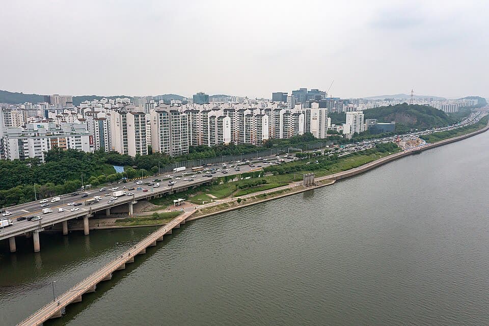
Aerial view of where the Anyangcheon meets the Hangang River
Aerial view of where the Anyangcheon meets the Hangang River · 2023 · Seoul Metropolitan Government · 2023 · KOGL Type 1

Difficulty · Official Seoul Trail rating

Easy

Official Seoul Trail rating: level 1 of 3 (easiest)

Rating systems differ between pages. An official grade follows the operator’s own scale, so an “easy” route can still take over three hours. Compare routes by walking time and distance as well. Getting to and from stations is described separately in each route.

1. Anyangcheon Downstream route

From Guil Station to Gayang Station: 10.2 km past 6 stops.

Difficulty
Easy
Walking time
About 2 hr 25 min
Distance
10.2 km
Area
Guro-gu · Yeongdeungpo-gu · Gangseo-gu
Official route page (Korean) ↗

Official Seoul Trail information · from the start of the route to its end

Route order

On smaller screens, scroll sideways

  1. 1Guil Station

    구일역

    Start
  2. 2Anyangcheon Stream

    안양천

  3. 3Yangpyeong Reservoir Eco Park

    양평유수지 생태공원

  4. 4Hangang River & Anyangcheon Stream Confluence

    안양천합수부

  5. 5Hwanggeumnae Neighborhood Park

    황금내근린공원

  6. 6Gayang Station

    가양역

    Finish

Getting to the start

The official starting point is Guil Station (Line 1) Exit 1. Use the map on the official route page to find the way from the exit to the trail.

NAVER Map ↗

Getting back

The route ends at Gayang Station (Line 9) Exit 4 (official information). Route 15 (Noeul & Haneul Parks) continues from this station.

Good to know

  • Stamp boxes: Guil Station and Hwanggeumnae Neighborhood Park. They are outdoors and the ink can dry out, so bring your own ink pad (official advice).
  • The Anyangcheon flows into the Hangang River west of Seongsan Bridge. The route passes this confluence.
  • From Gayang Station you can carry on along Route 15 (Noeul & Haneul Parks).

About the Seoul Trail

  • The Seoul Trail is a walking trail around Seoul: 21 routes, 156.5 km in total.
  • Parts of a route are sometimes detoured for events or construction. Check the official notices before you go.
  • Stamp books are handed out at Seoul Trail Information Centers and a few other places. They may run out, so call ahead (official advice).
  • Enquiries: Seoul Trail Information Center, +82-2-779-7902 to 7904
Seoul Trail notices (detours, Korean) ↗